
We are a mountain volunteer department with access to a mutual aid partner Boulder Emergency Squad; a volunteer technical services emergency response team. BES run a UAS program - Unmanned Aerial Systems, colloquially knowns as drones. BES UAS are systems because they carry technology; high definition cameras, heat sensitive cameras and radio technology to transmit those images (in real-time) back to ICP.
This summer a powerful lightning storm started a set of fires in remote areas of our district. Given the tough fire conditions in Colorado this year, and through Boulder OEM we had knowledge of the quantity of severe air-to-ground lightning strikes (a technology for another posting) we were already starting patrols when the calls came in of “smoke visible”.
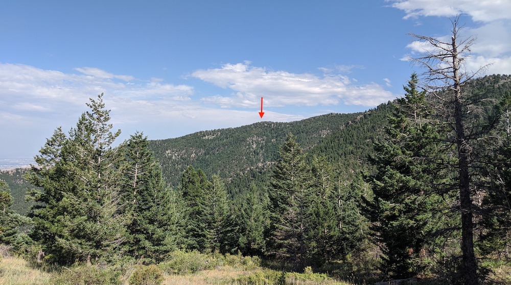
We proceeded to our typical canyon overlook spots, and quickly triangulated at least one smoke column. (Amusingly it was confusion around triangulation - and the intersecting lines not making sense - that let us first know we had the second fire, before we found the others.)
These lightning strikes fires were remote; hours of challenging hiking and vertical to get to, and much as we had generally triangulated their position, having the UAS take minutes to get over them allowed us a size-up, determine risks of spread and/or exposure, and scout for other fires and/or hazards on ingress/egress. The larger (more powerful) UAS took only minutes to fly the mile to the fire, was able to hover directly over it for relatively long periods; transmitting information and video images back to ICP.
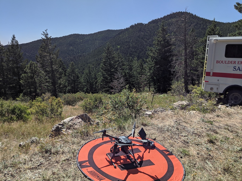
What made these fires ‘UAS friendly’ was our ICP (where our trucks where, and where BES parked their support vehicle and create their LZ) had the all important “line of sight” to the fires, and had little risk of other (higher priority) air traffic. (That said, BES pilots and their colleagues were constantly vigilant for this.)
Given we knew we had many hours of hiking to get to the fire (over rugged rocky terrain) we were able to request BES mutual aid and have them launch their UAS before we could get a crew on the fire. We used the UAS to check out the fire scene, but also to check on our crew as they hiked in.
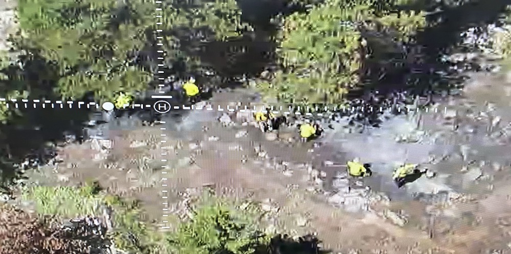
Having the UAS overhead allowed ICP uncommon insights to the fire scene, and the crew, and allowed for some scouting of escape routes to safety zones. Nothing beats crew L(A)CES and firefighter experience/situational awareness, but adding insights from above was informative. While crews were hiking in the UAS was able to locate a suspected third fire, and provide size-up and location. (The fourth fire, from the same lightning storm, showed itself the next day.)
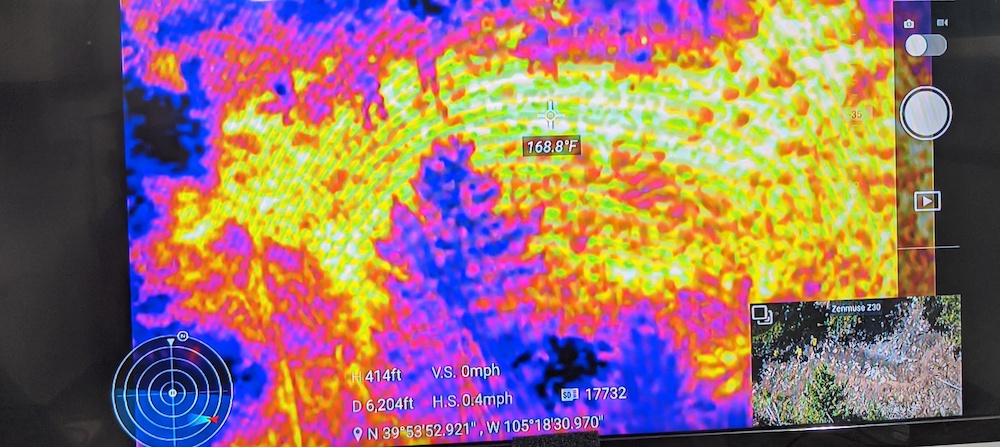
Of course we cold trailed by hand, but it was informative to use the UAS heat view to check hot spot temperatures, and to see if it uncovered any our ground crew had not detected.
Not every wildland fire will lend itself to using a UAS, and the BES UAS are very specialized (read powerful, high end, replete with technology … i.e. expensive) and come with trained/licensed pilots, but the potential for valuable contribution is there.
Sign up to hear more from Responserack on Volunteer Fire Departments, USFA NERIS and USFA NFIRS.
Responserack provides services for volunteer fire departments; member information services, incident reporting, NFIRS and so much more.