As the fire service transitions from NFIRS to the new National Emergency Response Information System (NERIS), one of the fundamental changes we’ll see is the replacement of “Property Use” with “Location Use.” This isn’t just a name change; it’s a shift towards a more descriptive and logical system for classifying incident locations.
For fire chiefs, especially in rural areas, understanding these new codes is important for accurate reporting and data analysis.
Some of these names are still more than a mouthful, and need some explanation. “Single Family Dwelling”, for example, is your typical rural family home.
The new Location Use field in NERIS is designed to be more intuitive. It uses a hierarchical structure, typically GroupName||VALUE, which provides clarity right away. For example, instead of memorizing a code like 419 for a single-family home, you’ll use a more descriptive value like RESIDENTIAL||DETATCHED_SINGLE_FAMILY_DWELLING.
This change helps reduce errors and makes the data more meaningful, even for those not deeply familiar with the coding system.
One example of the improved specificity, but which can be a bit confusing at first, is how NERIS handles single-family homes. NFIRS grouped most of these under code 419. NERIS splits them into two distinct categories:
RESIDENTIAL||DETATCHED_SINGLE_FAMILY_DWELLING: This is your typical standalone house / home. It does not share walls with any other home/dwelling (although it could have an attached garage).RESIDENTIAL||ATTACHED_SINGLE_FAMILY_DWELLING: This includes duplexes, townhouses, and any other single-family residence that shares one or more walls with a neighboring unit.Clearly, the operational difference in these two types of dwellings is significant. An incident at an attached dwelling immediately raises the risk of fire extension to an exposure, requiring a different tactical approach and potentially more resources. This new distinction allows for better pre-planning and more accurate risk assessment based on your community’s housing stock, and a better understanding of incidents that have occurred.
Having an attached garage (or car port) might seem to make it “attached” but a simple garage is included in the home. A home with an attached garage is still a detatched single family dwelling. If however the home was connected to a workshop or barn or other struct, then it goes from detatched to attached. In short, don’t worry about the garage.
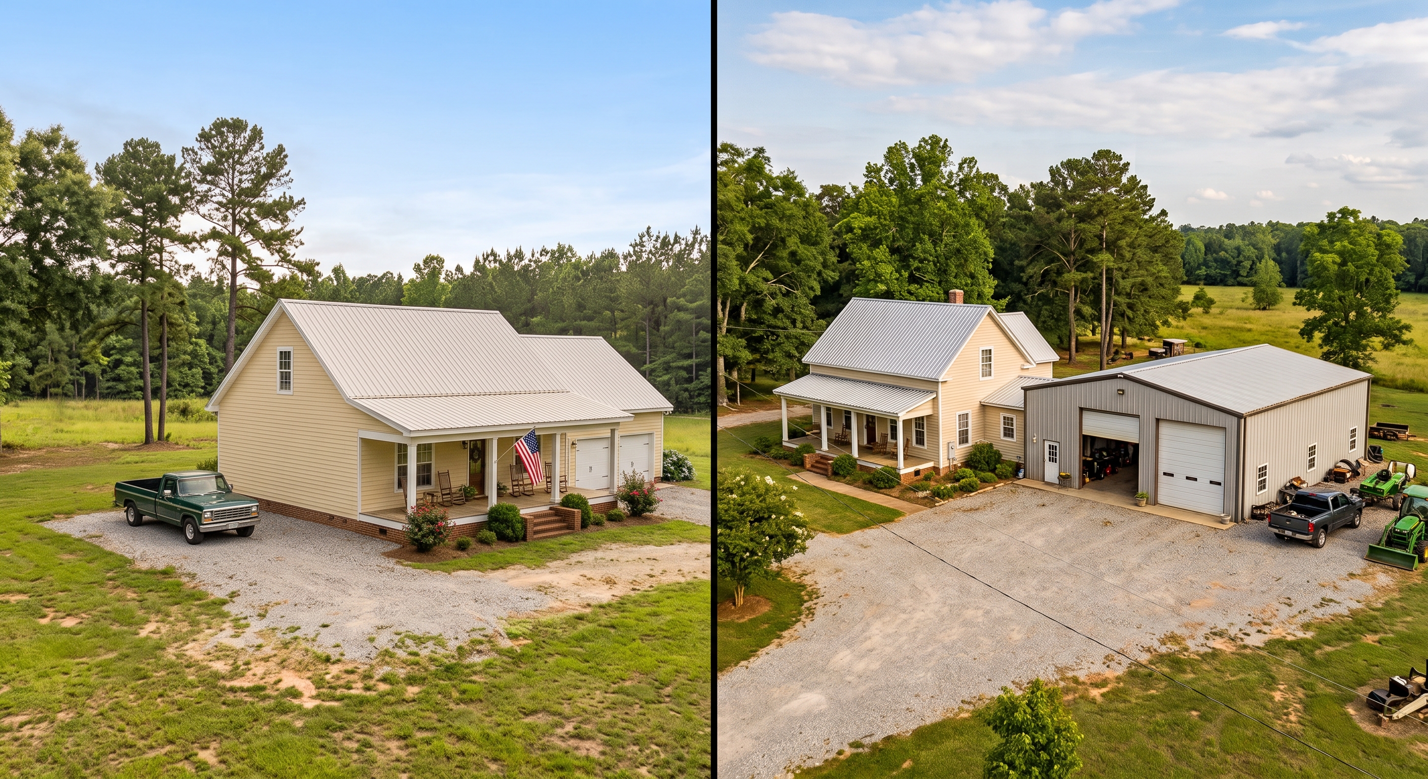
DETACHED and ATTACHED …
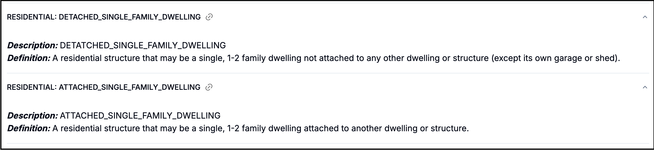
This is the clipping from the NERIS data dictionary.
A typical rural home: DETACHED.
P.S. NERIS recognizes the type in ‘DETATCHED’ (there should be one T not two) and are fixing this in a future NERIS release.
Many of the new Location Use codes are particularly relevant for departments serving rural and agricultural areas. Here are a few to pay attention to:
NFIRS had broad categories for agriculture. NERIS provides much-needed detail, allowing you to specify the exact type of agricultural location.
AGRICULTURE_STRUCT||STORAGE_SILO: Perfect for grain silo fires or rescues, a common and high-risk scenario in farm country.AGRICULTURE_STRUCT||FARM_BUILDING: A general code for barns and other typical farm structures.OUTDOOR||ORCHARD_CROPS_FARMLAND: This code is for incidents that occur in the fields themselves, not involving a structure. This is a critical distinction for tracking grass, field, and crop fires.AGRICULTURE_STRUCT||VETERINARY_LIVESTOCK: Differentiates large-animal vets from the small-animal clinics typically found in towns (COMMERCIAL||VETERINARY_PET).Rural departments often handle incidents far from any building. The new codes offer better ways to classify these events.
OUTDOOR||FOREST_GRASSLANDS_WOODLAND_WILDLAND_AREAS: Your go-to for wildland fires, providing a clear category for incidents in forests and open land.OUTDOOR||HIKING_TRAIL: Many departments perform rescues on trails. Now there’s a specific code for it.OUTDOOR_INDUSTRIAL||MINE: For departments in regions with mining operations, this allows for specific tracking of incidents at mines or oil fields.UTILITY_MISC||ENERGY_FACILITY_INFRASTRUCTURE: From substations to power plants, these high-risk locations are often situated in rural areas.RESIDENTIAL||MANUFACTURED_MOBILE_HOME: These homes are common in many rural areas and have unique fire dynamics. Having a specific code helps in tracking incidents related to them.RESIDENTIAL||UNHOUSED_TEMPORARY_SHELTER: This provides a way to classify incidents involving homeless encampments or other temporary shelters, an issue relevant to communities of all sizes.What was Property Use - Other — 000 is now “unclassified”:
UNCLASSIFIED||UNCLASSIFIED: Allows you to record a location use that is not currently listed in NERIS.
Here you’ll find our complete resources on location use, including a mapping from NFIRS:
Sign up to hear more from Responserack on Volunteer Fire Departments, USFA NERIS and USFA NFIRS.
Responserack provides services for volunteer fire departments; member information services, incident reporting, NFIRS and so much more.